this post was submitted on 11 Nov 2024
37 points (66.4% liked)
Map Enthusiasts
4729 readers
37 users here now
For the map enthused!
Rules:
-
post relevant content: interesting, informative, and/or pretty maps
-
be nice
founded 2 years ago
MODERATORS
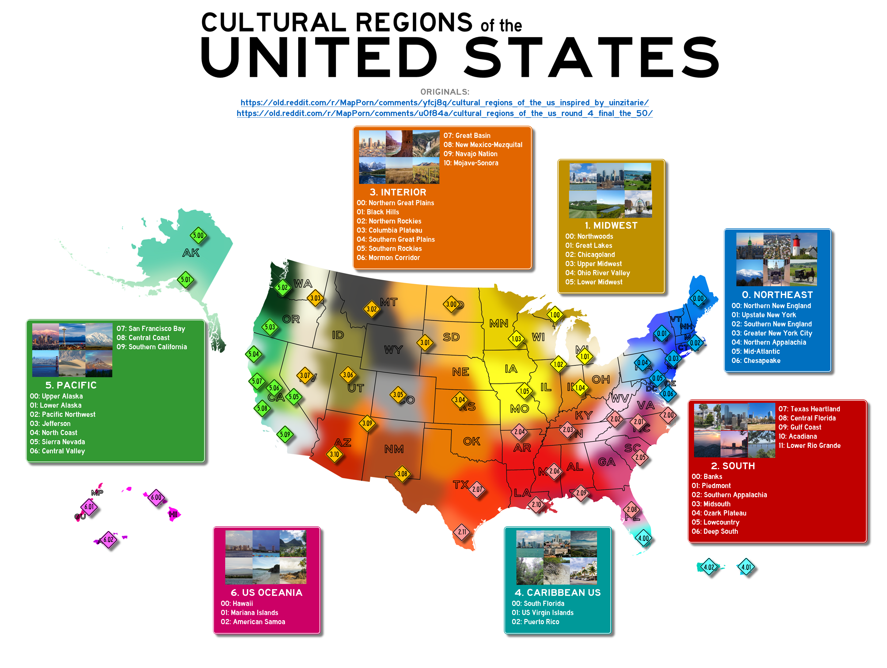
Most of these are pretty shoddy, but this one is really good. It's detailed and accurate about a lot of the idoiosyncrasies.
Like FlyingSquid I would have pushed "The South" a little further north into Western Pennsylvania, and up through Missouri into south Indiana. And what in the world is "The Northwoods," that's the YooPee and Wisconsin is upper midwest. But other than that it's spot on as to a whole lot of the details. South Florida as part of the Caribbean, Washington/Oregon as part of the interior once you get away from the coast... it has a lot of little important details right.
load more comments
(5 replies)
