everydayhiker

joined 2 months ago
 

Nature Walk, 0.4 m, may be extended along lake shore

9 ft elevation gain

Hiked 7/17/25

Flickr Album

The mighty Mississippi River traces its source back 2,552 miles to Lake Itasca near Park Rapids, MN. This quick nature walk will take you to the humble beginnings where you'll see the first 'rapids' and bridge crossing. Also learn the history of Mary Gibbs, a veritable badass conservationist in her day.

A signpost beside where the Mississippi first flows out from Lake Itasca. Reads 'Here 1475 ft above the ocean the mighty Mississippi begins to flow on its winding way 2552 miles to the Gulf of Mexico.'

A small statue done by a local artist, Jeff Savage, for the park in 2005. In Anishinabe (ojibwe) culture, women are the caretakers of the water, which is meant to be symbolized in this statue.

A small flattened log bridge is the first crossing on the Mississippi River.

[–] everydayhiker@lemmy.world 1 points 1 day ago (1 children)

Should be an arrowleaf balsamroot, which is in the sunflower family. I’ve always just called them balsam flowers, but I guess I’ve never really seen the other balsam flower that people grow in gardens. I feel like I butchered this post haha.


Moderate, 10.8 mi Out and Back

1,004 ft elevation gain

Hiked 7/14/25

Flickr Album

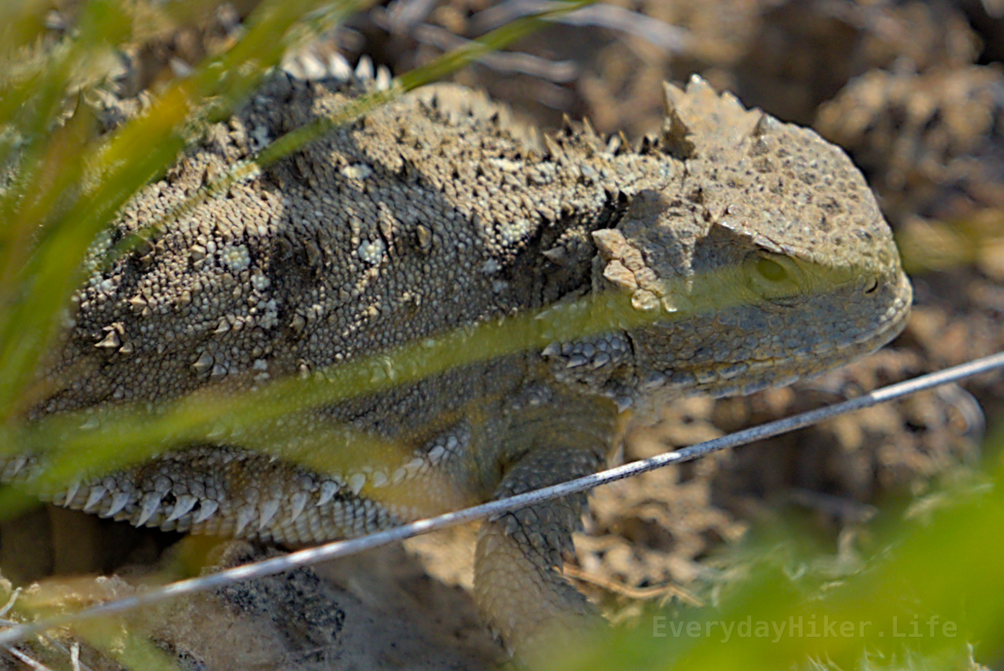
I am all about petrified forests. Petrified wood is my favorite rock no question and I'm a huge fan of badlands. About a mile to the forest and you could end there and return, or extend onto the grasslands, which adds miles and wildlife; birding, bison, rattlesnakes, short-horned lizards, wild horses, tumblebugs, prairie dogs and much more. Same hike I saw the Prarie Rattlesnake I posted a while ago. Returns to a second section of petrified forest to complete the loop.

Large petrified stump, reminded me of a big mushroom.

A couple of petrified stumps with the valley floor behind them.

A Mourning Dove takes flight from the petrified stump.

A couple of wild horses walking down the trail. The grayish one seemed pretty disappointed that I was happy to give them space.

A fly micromanages a tumblebug, who did all of the work pushing the ball of dung.

A Prairie Dog giving me the mean mug.

[–] everydayhiker@lemmy.world 1 points 1 day ago

Hell yeah, I love bee balm! Looks great and its such a great attractor.

[–] everydayhiker@lemmy.world 1 points 2 days ago* (last edited 2 days ago)

Just crossposted, thanks for the suggestion!


cross-posted from: https://lemmy.world/post/34209948

Saw this American Goldfinch having a breakfast snack at Makoshika State Park in Glendive MT. Taken 7/13/25. Originally had it marked as a tanager

An American Goldfinch looking at me from its perch on a Balsam flower.

[–] everydayhiker@lemmy.world 2 points 2 days ago

Nice! It looks so great when it covers a large area!

[–] everydayhiker@lemmy.world 3 points 2 days ago

Nice! Yeah, they really pop out of their surroundings.

[–] everydayhiker@lemmy.world 2 points 2 days ago (1 children)

Absolutely! Badlands are some of my favorite places to go, I always call them my spirit landscape haha.

[–] everydayhiker@lemmy.world 3 points 2 days ago (1 children)

Yep, totally had it marked wrong from the get go and didn't even notice as I was copy pasting. Hoped to correct in time, but always appreciate corrections.

[–] everydayhiker@lemmy.world 2 points 2 days ago

Yeah, I was blindly copying what I had saved before I realized I had marked it wrong from the get go. Been going back and changing all the different places I put it before I noticed. Hoped I got it corrected before anyone else saw, but appreciate the heads up


Saw this American Goldfinch having a breakfast snack at Makoshika State Park in Glendive MT. Taken 7/13/25. Originally had it marked as a tanager

An American Goldfinch looking at me from its perch on a Balsam flower.


Easy, 0.6 mi loop

135 ft elevation gain

Hiked 7/13/25

This short hike has just enough of a hillside to keep it from being just a nature walk, but still very accessible. Takes you around a small coulee with a natural bridge over a dry creek and around one moderate sized mound, which has stairs notched into it. Multiple coal seams can be seen on hike. KT boundary may be seen from viewpoint other side of road near trailhead.

Looking across the coulee towards the hillside with several capstones. Stairs may be seen at the top leading down.

Steps molded into the melty hillside as part of the trail.

Located on the other side of the road from the trailhead, a viewpoint will allow you to see the KT boundary, which is the dark line in the top right just about flush with the blue skyline.


Nature Walk, 0.4 miles or less out and back

69 ft elevation gain

7/13/25

The overlook at Caine's Coulee offers a great view of the Twin Sisters formation, which may also be walked right up to via a short trail leading from the parking lot. One of the most accessible ways to get up close to some of these large formations in the park. Saw a Ruffed Grouse nearby as well.

Twin Sisters as seen from the trail. You'll go right up to the hoodoos while hiking.

A Ruffed Grouse seen near the parking area for Caine's Coulee.

A gnarled capstone on to of its foundation.

[–] everydayhiker@lemmy.world 2 points 3 days ago

Yeah, I’m not too sure, possibly the hardiness of the flora and needing more ‘gut space’ to help break it down? I know there was a blip somewhere in the museum disussing how the dinosaurs were starting to be dominated by larger species near the extinction. May have been the same forces at play. I also think, in general, a cooler climate supports larger animals.. as per the second comment, yeah I absolutely love Montana. Don’t think I could deal with the winters, but I try to make it to at least a part of it every year.

[–] everydayhiker@lemmy.world 1 points 3 days ago

Ooh, I’ll add it to the list, thanks!


The Saturday Tour includes the Nature Walk 'Diane Gabriel Trail" as well as the lab access. $10, the fossils in the lab are pretty cool, I wish you had more time with them. Tour is done by the seasonal intern, but worthwhile if you happen to be able to catch it. Trail no longer has the large Hadrosaur on site unfortunately, although its to preserve it.

Flickr Album

No trip to Makoshika State Park would be complete without visiting the small free museum and visitor's center, which houses a variety of small fossils that can be touched as well as information on the surrounding badlands, the KT boundary, and the dinosaur fossils that have been found at the Park.

I believe this was also a replica, but possibly had some original fossil section, of a Triceratops fossil found at the park.

Ancient Bison skull found at the park. Shows the massive difference in sized between Bison then and now. They didn't list the date on this, but the 'Ancient Bison" species was 10k-70k years ago.

Replica of dig site of a Thescelosaurus found at the park.

The following are all from the lab section and only seen on the tour. Also had some turtle shell fossils and other coll oddities.

Part of a fossilized brow horn from a triceratops, along with a rib head.

'Hand' bone fossils of a Champosaurus.

A fossilized Ceratopsian rib bone. Almost the size of my wrist.

Fossilized redwood tree pine cones.

[–] everydayhiker@lemmy.world 2 points 4 days ago (2 children)

Hmm, I’m not too sure. Seems like half of the things named in that area are food terms repurposed or ‘hungry ____.’ Probably just a bunch of people that have been caught out in the badlands being hungry haha. I’ll have to look up hingry horse sometime, not sure if I know that one. Yeah, I don’t make it to eastern Montana as often, but it has some really great spots for sure.


Moderate, 5.2 mi Out and Back

1,109 ft elevation gain

Hiked 7/11/25

Flickr Album

c/wildlifephoto post of a Mountain Bluebird seen on the trail from above.

One of the longer trails in this small state park in eastern Montana, it is mostly easy with a couple large hill climbs. After is along a ridgeline looking down into badlands valleys dotted with hoodoos. Park is known for its dinosaur fossils and the KT boundary, also has a disc golf course.

The trail leads on to some weathering sections of badlands in this area. Good footing, but watch for sinkholes.

A collection of hoodoos from the small garden area.

A small boulder field from where the columns collapsed under their capstones.


Managed to see a Mountain Bluebird while hiking along Gunner's Ridge in Makoshika State park, eastern Montana (Glendive). Photo is pretty heavily cropped as I was still pretty far off, but that bright blue was visible even from a distance for me.

Mountain Bluebird in profile that was perched on a capstone below the trail, a little less cropped than previous.

Even less cropped photo of the Mountain Bluebird on a capstone, with some of the eroding layers beneath.

[–] everydayhiker@lemmy.world 2 points 6 days ago

It’s along the northern border fairly west in MT, so I think maybe 4 hours if you were headed from Yellowstone. I’ve never gone direct between the two on any of my visits but it’s certainly an option.


Moderate to hard, 13.4 mi Out and Back

2,411 ft elevation gain

Hiked 7/9/25

I saw a Grizzly Bear while hiking along this trail, photos on c/wildlifephotography.

Oldman Lake hosts the first campsite for a couple of hikes continuing from there and not usually out and back. Its a section of my all time favorite hike, the Dawson-Pitamakan loop trail, which I ended up only doing this section of as an out and back due to bee sting and a tired thigh from closing out CA.

Flinsch Peak and an unnamed lower peak in front of it.

What I believe to be a Canada Jay staring down at me. Was constantly on the move so only had a acouple decent photos before it left the area with its pals.

Small double waterfall seen along the trail. 1/8s exposure.


Photos of a Grizzly Bear I saw on 7/9/25 hiking the Pitamakan Pass trail in Glacier National Park.

Grizzly bear searching around on the hillside. Decent view of the hump on its shoulder/back.

Grizzly bear in profile from a distance. I think later hikers may have dealt with a closer bear.

Shot of the Grizzly looking at me. Didn't show any interest in me from far away and may not have really registered I was there.


Hard, 13.76 mi out and back trail

3,822 ft elevation gain

Hiked 7/6/25

Flickr Album

Likely the most known hike in Waterton Lakes, this has it all. A boat ride, two massive waterfalls, a tunnel, chains section along the cliff wall, Cutthroat Trout, Bald Eagles, and a small brush with the US border. Epic throughout, add Hells roaring canyon on the way back for geological features.

One of the many good views along the shoreline of Crypt Lake, Sarcee Mountain rises above it all from the US side of the border just off of the trail.

The viewpoint from maybe 15 ft beside the main waterfall, which you can also get on top of. Unnamed lake below and I am not sure if that peak would be considered base of Sarcee Mountain or something else.

Trail shot from when you are near level with Crypt Lake but still maybe half a mile away. Sarcee mountain forms the bowl around the lake.

This was the final hike I did while in Canada, absolutely wonderful country that I would highly recommend visiting if you have not. I'll have a short hike coming up from when I just drove over the Great Lakes at the start of last week but this hike was the final of the 3 months around the Rockies.

view more: next ›