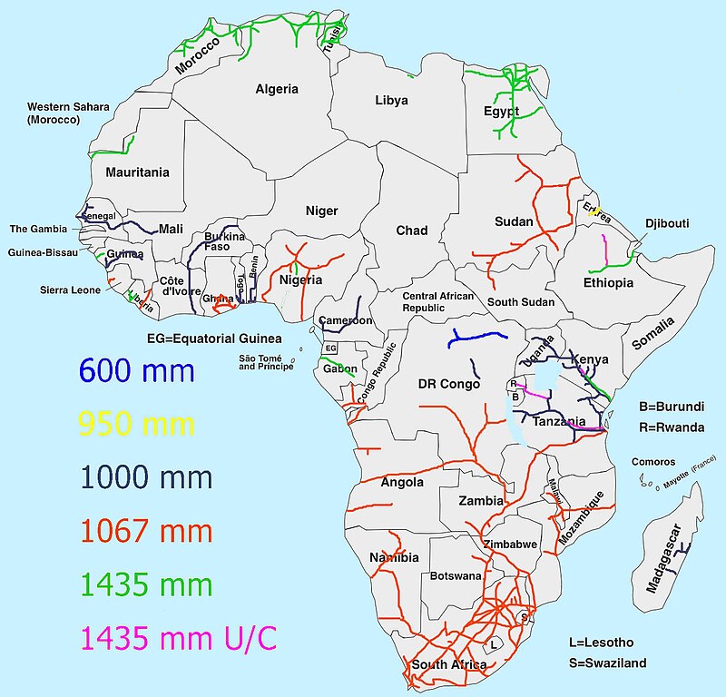
Seems you have a few extra lines compared to openrailwaymap, are those all operational?
Pity so few cross-border connections, maybe we need an interactive map of the future network.
On openrailwaymap, you have to zoom in pretty far before smaller branch lines are shown. That might be why this map looks to have extra lines.
I wonder what economic opportunities would arise if there was a single-gauge link from Egypt to South Africa?
This doesn't answer your question, but Great Britain tried during their colonial rule. I'd be curious too though about a modern version.
Some for sure. I wonder if that's something somebody like China might consider funding. Which countries to go through would be a big question. Sudan-Ethiopia-Kenya-Tanzania-Zambia in 1067 would be the best option right now I think, given the political and economic situations those nations, and what's already there.
hi, can someone explain what the difference is between 1435mm, and 1435mm u/c? it's not obvious from the picture. thanks!
ah, thank you!
Surprisingly phat trains run on 600mm gauge railways 
my brain refuses to accept the fact that they can avoid tilting over
Map Enthusiasts
For the map enthused!
Rules:
-
post relevant content: interesting, informative, and/or pretty maps
-
be nice
