12

Rotation required by Pareidolia ;)

R-MastCam-Z: 110mm (full zoom)

Mast Azimuth: 68.8394

Mast Elevation: -39.732

Sol 1274 (September 20, 2024)

Site: 59.3872

NASA/JPL-Caltech/ASU/MSSS

Raw image: https://mars.nasa.gov/mars2020-raw-images/pub/ods/surface/sol/01274/ids/edr/browse/zcam/ZR0_1274_0780039250_863EBY_N0593872ZCAM03981_1100LMJ01.png

6
1274 - Traverse map (lemmy.world)
5

Drive was during September 19, 2024 - Data from JPL

14

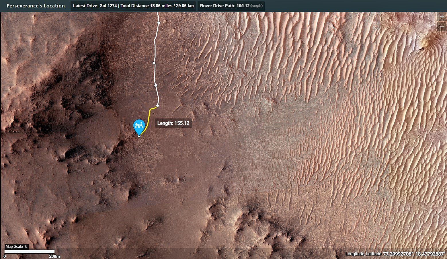
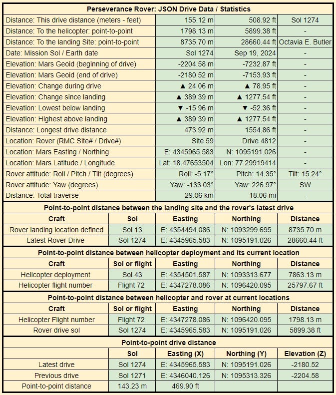
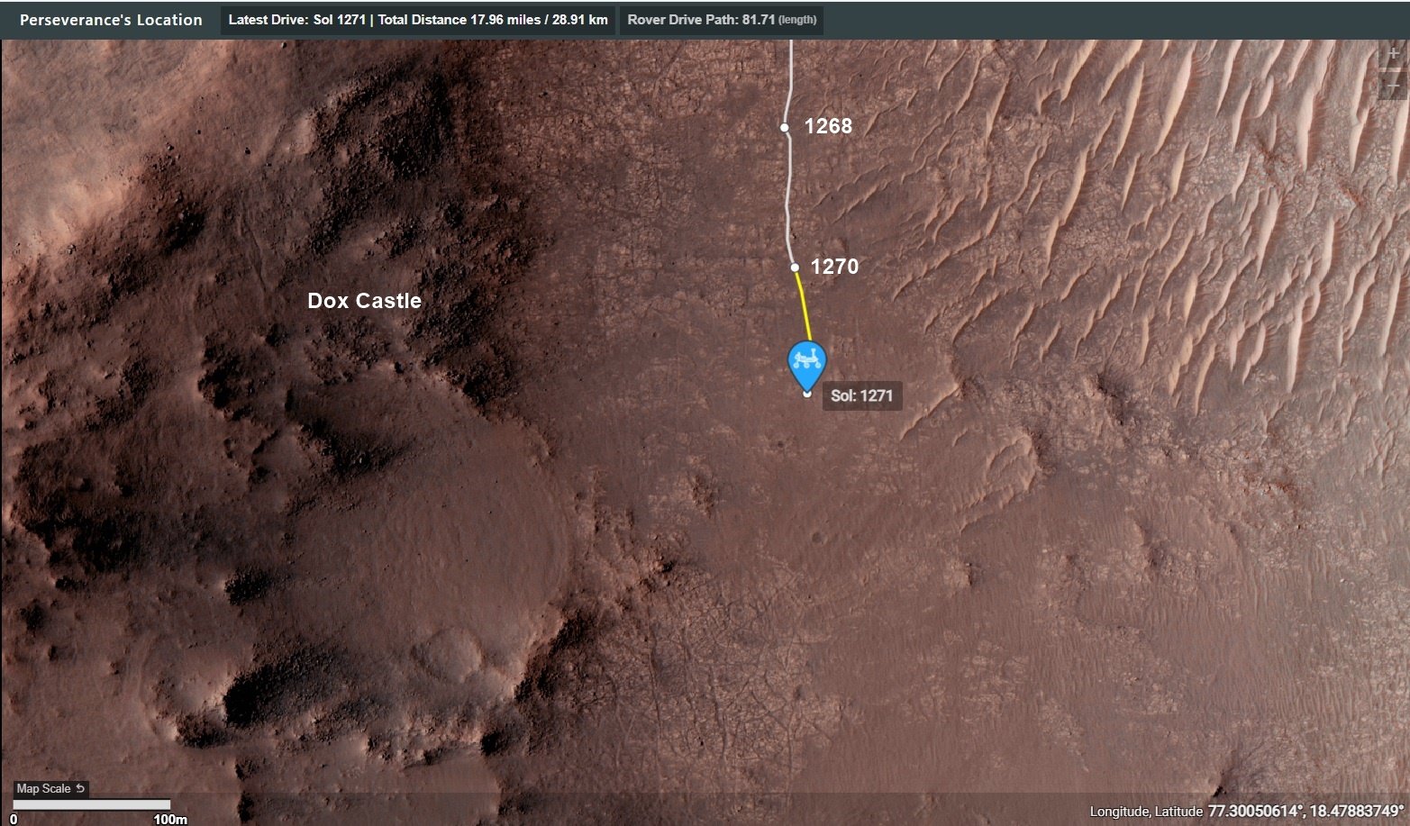
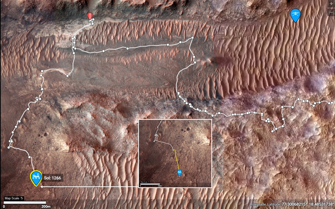
Awaiting the official distance and the updated traverse map.

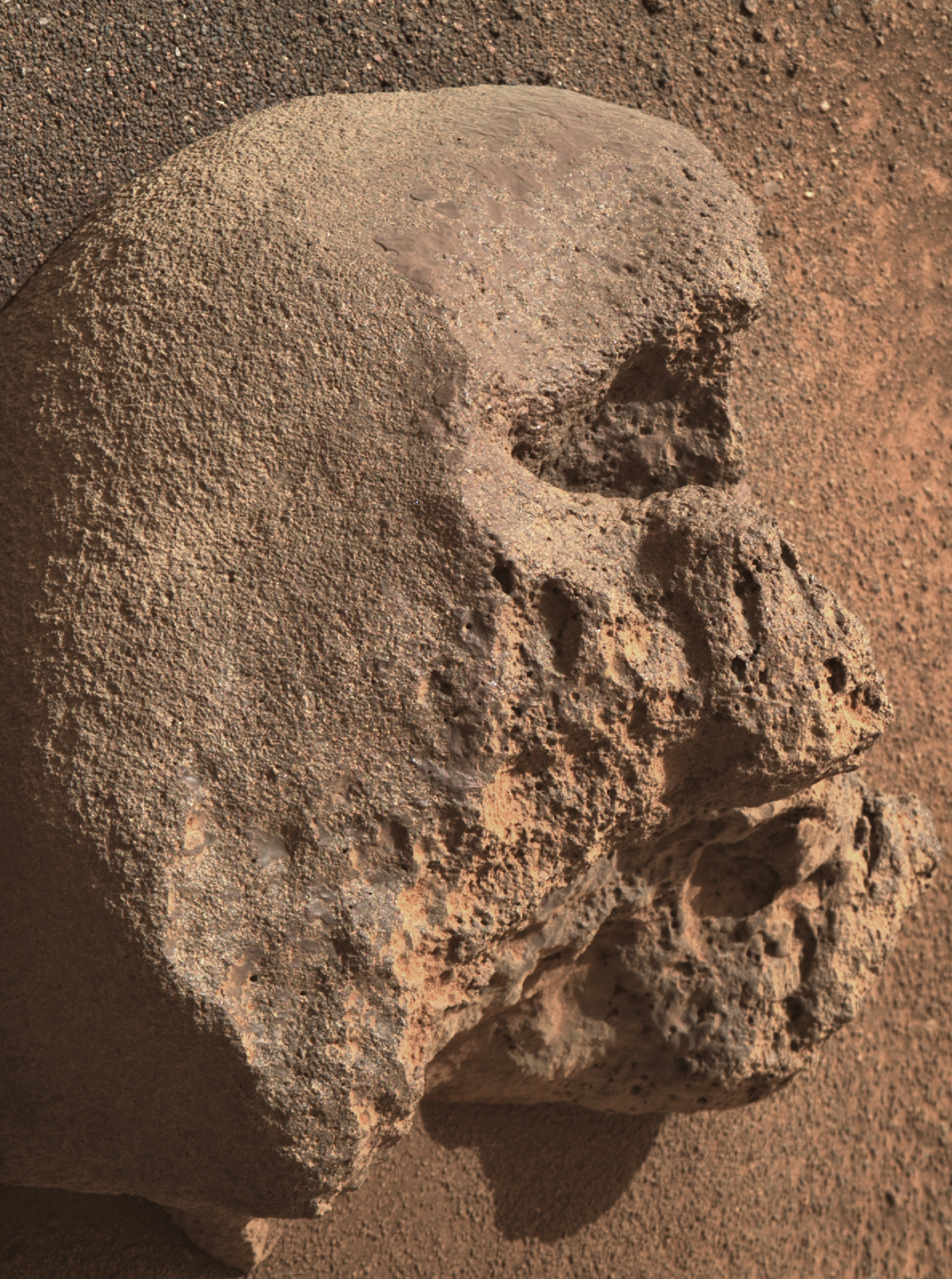
Looking at the post drive images I presume that we are still on the margin unit, but very close to the basal unit of the crater rim (just beyond the workspace).

JPL stated that "Dox Castle" is a major science waypoint, but we're probably a little south of the location shown on an earlier map, but we are close to the transition zone.

Except for a series of short walkabout drives we could be around here for some time examining the transition between the rim and the rocks formed in the ancient lake. I'll share the official traverse map and drive data as soon as it is released.

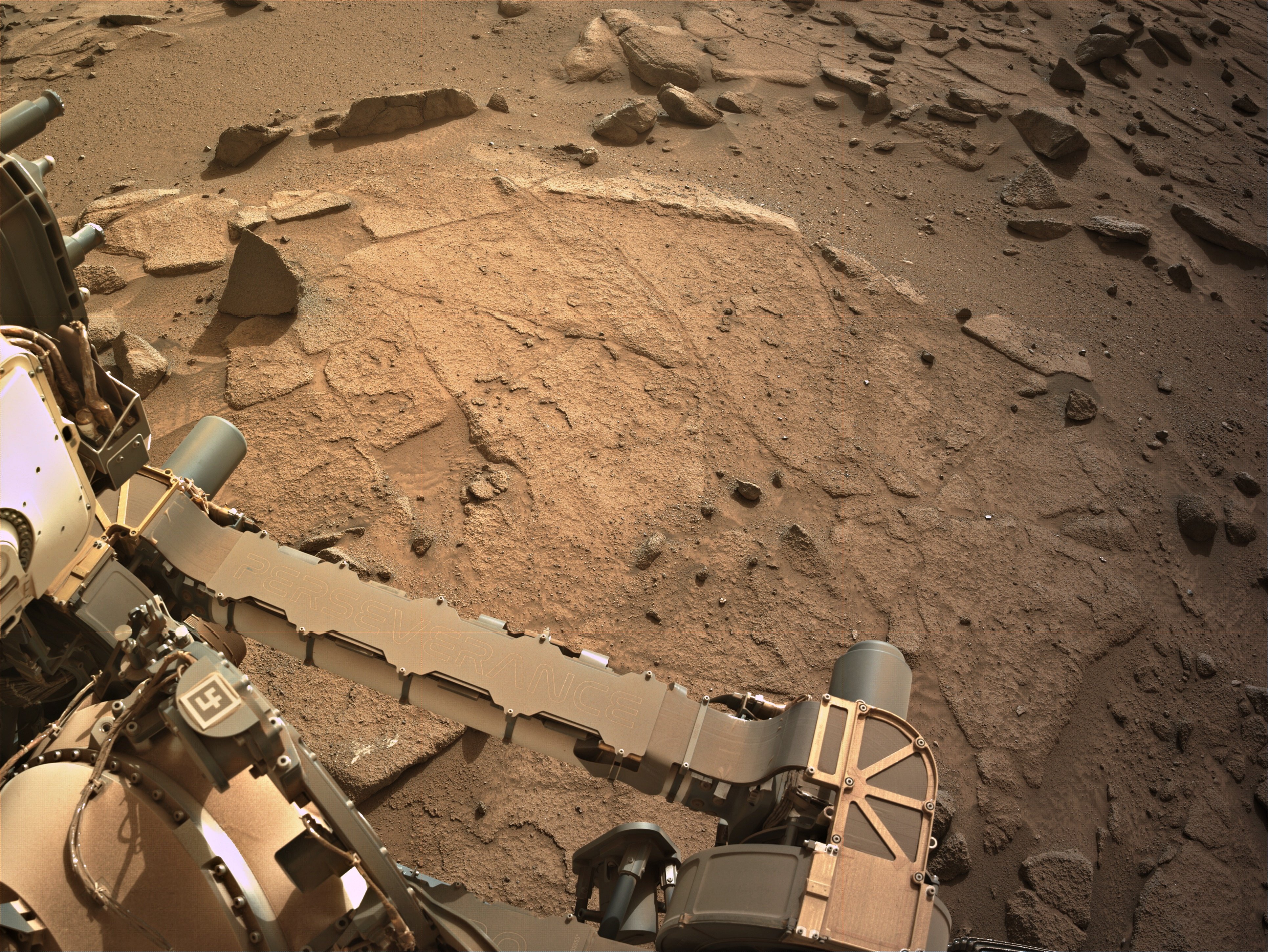
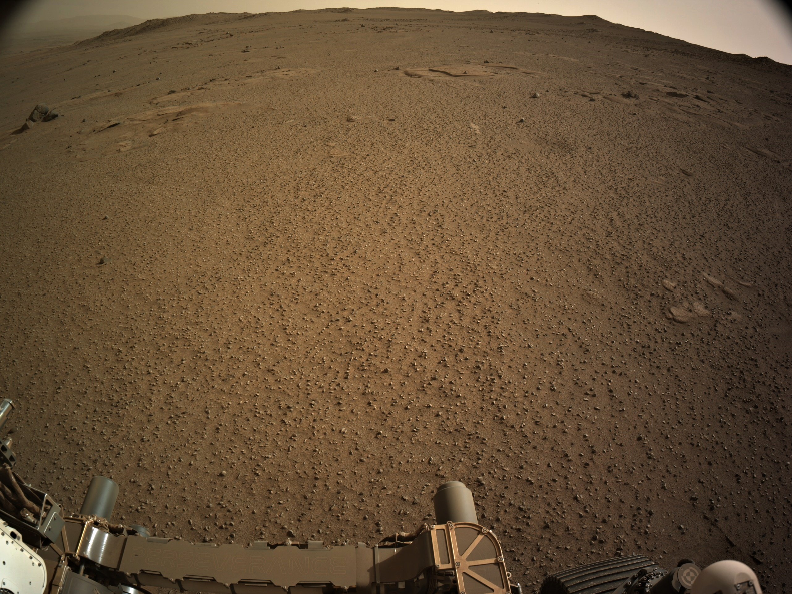
Attached is a 9-tile end-of-drive L-NavCam composite, featuring the rover's robotic arm workspace

Size - 3862x2902px

Assembled in MS-ICE.

Site - 96-4812.

Sol 1274 - September 19, 2024.

Credits: NASA/JPL-Caltech

26

Perseverance Mars rover is on its ascent to the rim of Jezero Crater, and it captured a portion of the journey with one of its navigation cameras. Forty-five frames were stitched together to create this video showing the rover's progress on Aug. 22, 25, and 26, 2024, the 1,247th, 1,250th, and 1251st Martian days, or sols, of the mission. During the time period captured, Perseverance covered a distance of about 530 feet (160 meters) and gained about 115 feet (35 meters) in elevation.

Credit: NASA/JPL-Caltech/PIA26376

23

Dox Castle will be our first chance to do rim science, to search for evidence of the transition between the margin and rim materials, and to start piecing together the stratigraphic history of the rocks that make up the rim of Jezero crater.

16
[-] paulhammond5155@lemmy.world 2 points 4 days ago

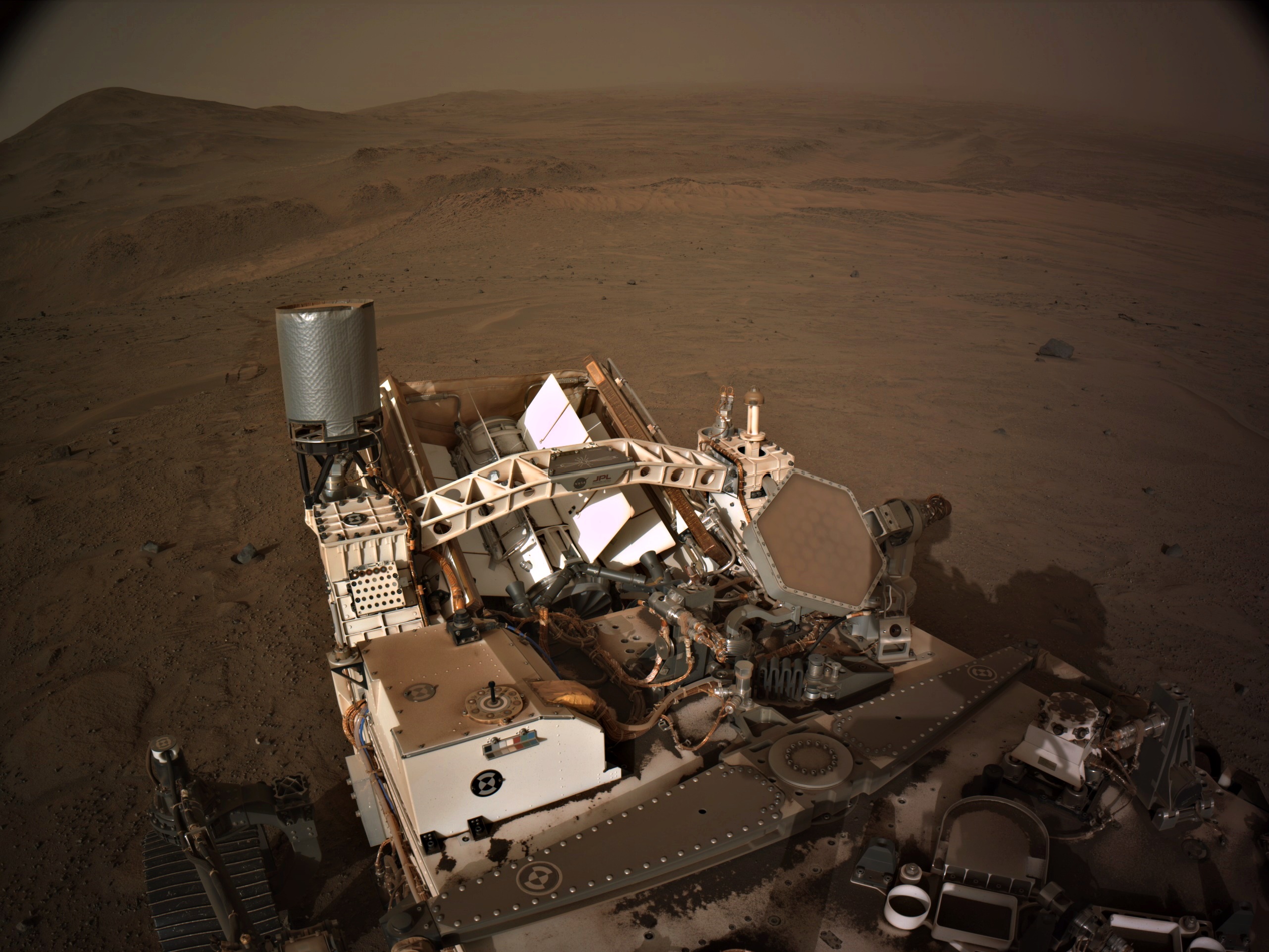
BattleBots on Mars :)

24

4-tile end-of-drive NavCam. The terrain in front of the rover (small pebbles) in the sand, is often a good sign of reasonable driving conditions. We're not too far from "Dox Castle" (a possible science waypoint), so we may see the rover change course soon.

Awaiting the post drive data (JSON) and official map

[-] paulhammond5155@lemmy.world 3 points 5 days ago

MG seems to like click bait titles for his YT videos. I try to ignore the titles so I can enjoy the content :)

14

Episode 180 Last month, Perseverance began an epic climb up the rim of Jezero crater to explore new science targets on the outside. After three weeks and ten drives, Perseverance was only about a tenth of the way up. But then something changed.

[-] paulhammond5155@lemmy.world 3 points 5 days ago

Hopefully we'll see more funding on Earth to research on similar coatings that occur here on Earth

28

The climb continues with another good drive/climb during sol 1268. The views from this record elevation are a little spoiled by elevated dust levels. Let's hope the dust subsides a little before the rover drives out of the crater. NASA/JPL-Caltech/MSSS

21

Screen shots from the official map - https://mars.nasa.gov/maps/location/?mission=M20

11
1266 - Drive data (lemmy.world)

Data acquired from JPL's JSON feeds

[-] paulhammond5155@lemmy.world 11 points 3 months ago* (last edited 3 months ago)

@weariedfae

It is possible, as the rover is heading for Bright Angel (BA) it's the west of the current location. This float rock could be from Bright Angel, so could have been washed down Neretva Vallis by floods etc ~3 billion years ago. BA appears to the white in the HIRISE images, BA is thought to be the oldest rocks the rover will encounter and probably predate the impact that formed the crater, so they could be of volcanic origin... Watch this space

Edit. fixed typos

[-] paulhammond5155@lemmy.world 12 points 6 months ago

It may not be able to fly, but it is far from fully broken.... It has returned a huge number of images since its last flight, as well as data. They hoped to continue to get data right up until the rover left the crater, but a bad sandstorm could prevent that

[-] paulhammond5155@lemmy.world 7 points 6 months ago

Flight 72 was during Sol 1036. During Sol 1036 the rover was stationed at site 49.370 (E 4348233.930, N1096134.251) the point to point distance to where it is now is 693.85 meters (2276.41 ft).

However the traverse to reach the current location contained a few loops and science waypoints, so the total drive distance was 1,117.31 meters (3665.7 ft).

The point to point distance between the rover and the helicopter at this time is 416.55 meters (1366.62 ft)

[-] paulhammond5155@lemmy.world 14 points 6 months ago

From the data that JPL got before the brownout the helicopter was only 1 meter from the ground when it all went wrong. Sadly the brownout meant no data from the IMU was saved in those last seconds before it landed. It must have experienced some pretty harsh vibrations. But it powered up again and has been communicating via the rover to Earth. It has sent back an incredible 2,396 images and a bunch of engineering data since the emergency landing (all those images are post landing) Link to the post landing images:- https://mars.nasa.gov/mars2020/multimedia/raw-images/?begin_sol=1036&end_sol=1136&af=HELI_NAV,HELI_RTE

Since deployment it has sent back 14,551 images (so far) and they will stay in touch with it until the rover drives out of Jezero when radio contact will be lost. The helicopter has no off button. It will wake up every morning that its batteries etc keep working, it will wait until a preset time and it will listen for a radio call from the rover for exactly 50 minutes, if it gets no call, it will go back to sleep, and awake the next day and repeat until its no longer able.

[-] paulhammond5155@lemmy.world 10 points 6 months ago

The terrain (deep sand) is too dangerous for the rover to traverse across (it could get stuck and that would be mission over for the rover) Even if it could traverse across, there is no way to pick up the helicopter. Instead the helicopter will spend the rest of its days waking up every morning and listening for a transmission from the rover for a total of 50 minutes, if it gets no signal during those 50 minutes, it will sleep until the next day and repeat until it is no longer able to wake up. Since flight 72 the Helicopter has sent back over 2,300 images.... Link to all those images: https://mars.nasa.gov/mars2020/multimedia/raw-images/?begin_sol=1036&end_sol=1136&af=HELI_NAV,HELI_RTE

[-] paulhammond5155@lemmy.world 10 points 7 months ago

They did plan some blade rotations, then this image came down. I hope they do more imaging. there should be a lot more images on the helicopter, lets see what is made public in the days ahead

[-] paulhammond5155@lemmy.world 8 points 8 months ago

I'll be keeping an eye open for those new ground images... Watch this space :)

[-] paulhammond5155@lemmy.world 7 points 8 months ago

Hopefully not...

We did get roughly 190 NavCam images from flight 70 via the rover in the day or so leading up to flight 72. So we know that there were good comms between the two craft in the days before 72 flight. If it landed somewhere other than it took off from there could be comms issues. In past flights they have lost contact during landing. So they may be able to quickly re-establish comms. However JPL have not published the raw data to show exactly where flight 71 landed. Flight 71 appears to have been a very hard landing, all we know it was an emergency landing. But there is strong evidence in the post flight images that the ground under the helicopter had been contacted by parts of the helicopter. (see previous posts here)

view more: next ›

paulhammond5155

joined 1 year ago