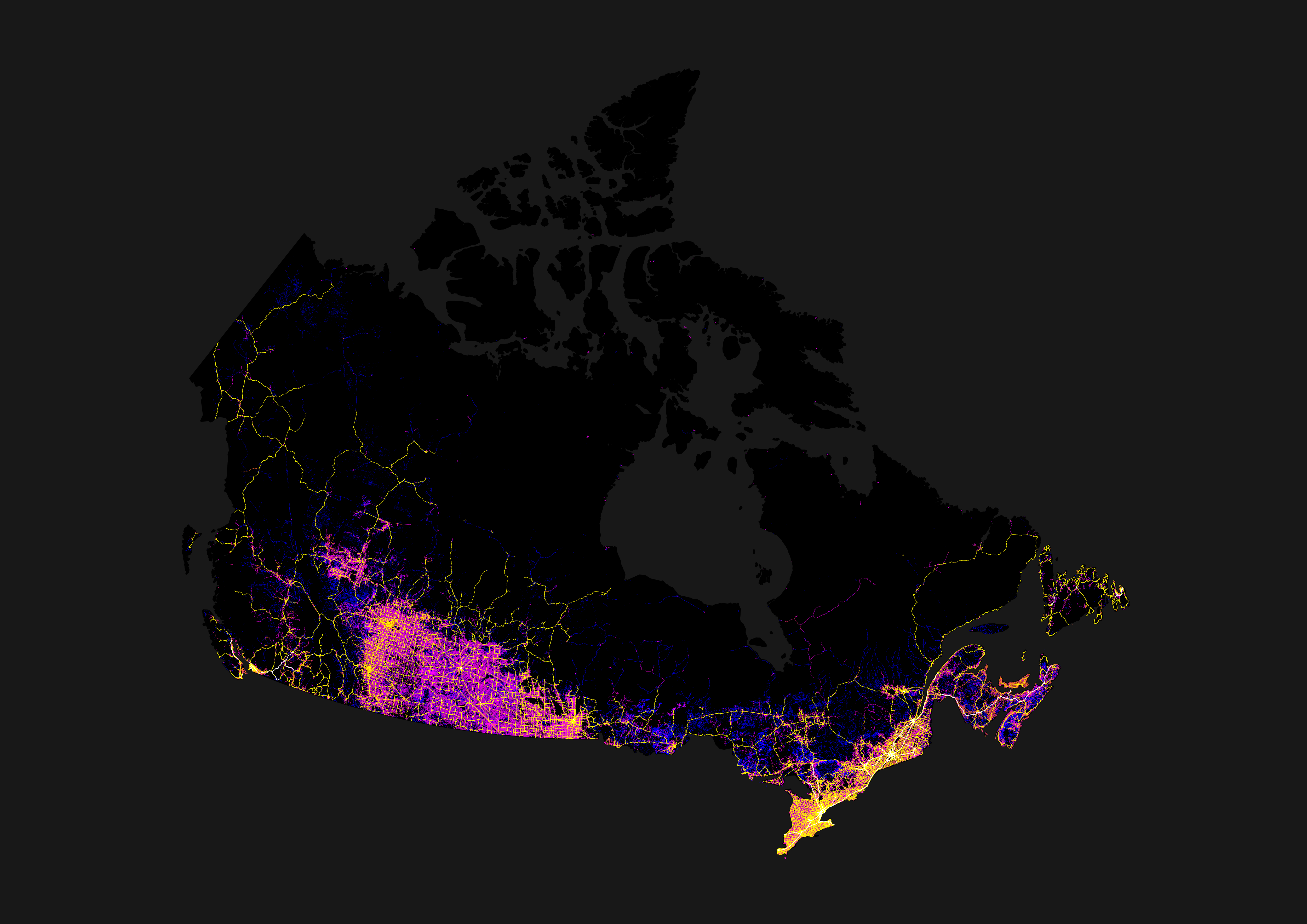
Google reverse image search shows this as the original source: https://imgur.com/map-roads-of-canada-w7lDes8
What's going on Canada?
🍁 Meta
🗺️ Provinces / Territories
🏙️ Cities / Local Communities
Sorted alphabetically by city name.
🏒 Sports
Hockey
Football (NFL): incomplete
Football (CFL): incomplete
Baseball
Basketball
Soccer
💻 Schools / Universities
Sorted by province, then by total full-time enrolment.
💵 Finance, Shopping, Sales
🗣️ Politics
🍁 Social / Culture
Rules
Reminder that the rules for lemmy.ca also apply here. See the sidebar on the homepage: lemmy.ca
Google reverse image search shows this as the original source: https://imgur.com/map-roads-of-canada-w7lDes8
And those towns were originally settled by farmers getting land adjacent to the railways, centered around the railway stations. They needed trains to get their produce to market, and to order their supplies from "the big city".
Those early railroads had to build a water station about every 30 miles, as that was the distance the steam locomotives of the day could travel before needing to get more water. There were larger stations every 3rd or 4th water stop to re-supply with coal.
The history of the railroads is the history of Canada, especially so on the prairies.